
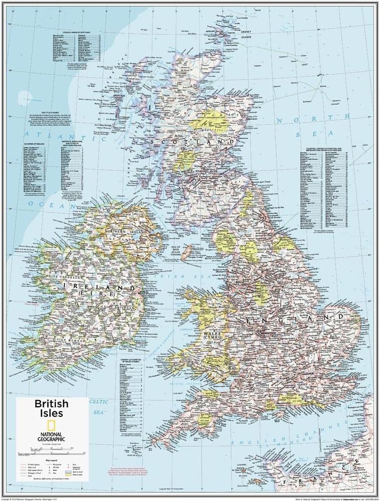
National Geographic Maps: British Isles Wall Map - Compact - 21 x 16 inches
Product details
| Management number | 221559395 | Release Date | 2026/05/03 | List Price | $8.40 | Model Number | 221559395 | ||
|---|---|---|---|---|---|---|---|---|---|
| Category | |||||||||
This British Isles map of physical and political features can fit in any space. Showcasing the country and surrounding regions in stunning detail with state-of-the-art cartographic techniques delivering accuracy and exceptional quality, the innovative and engaging design makes the content easily accessible and user-friendly.Ideal for classrooms with an emphasis on teaching geography or environmental themes. The inclusion of physical features gives your students a genuine feel for how our world appears.This map uses a bright, easy to read color palette featuring blue oceans and stunning shaded relief that has been featured on National Geographic wall maps for over 75 years. It is drawn in a Polyconic projection, where the parallels are all non-concentric circular arcs. Names of geographic features are carefully placed on the map to maintain legibility. An inset of the Shetland Islands and details on the counties, districts and boroughs of both Britain and Ireland add details to this classic map.National Geographic's maps are the standard by which all other reference maps are measured. The maps are meticulously researched and adhere to National Geographic's convention of making independent, apolitical decisions based on extensive research using multiple authoritative sources.This map is found in National Geographic's 10th Edition World Atlas, published to mark the 100th anniversary of National Geographic Cartography, and is now available as a stand alone product.Printed on thick paper suitable for display on your home, school or office wall. Your map is rolled and packaged in a sturdy tube to protect it during shipment.
- COMPACT WALL MAP: This wall map measures 21 x 16 inches, which is a perfect size for a wall poster collection
- HIGH QUALITY PRINT: Printed on thick paper suitable as a poster for display on your home, school or office wall.
- ROLLED IN A STURDY TUBE: Your map is rolled and packaged in a sturdy tube to protect it during shipment
- A MUST-HAVE FOR COLLECTORS: Be the first to own this map individually, previously only available as part of the 10th Edition of the National Geographic Atlas!
- ICONIC CARTOGRAPHY: National Geographic's maps are the standard others are measured against. You can count on this product having the highest quality content and display in the industry.
| UPC | 697942176384 |
|---|---|
| Color | full color |
| Map Type | Physical, Political |
| Brand Name | National Geographic |
| Paper Size | 21 x 16 inches |
| Part Number | 697942176384 |
| Paper Finish | Glossy |
| Paper Dimensions | 21 x 16 inches |
| Item Dimensions L x W | 21"L x 16"W |
Bestseller ranking
Beard Conditioners & Oils






Customers who viewed this product also viewed
Maps


Correction of product information
If you notice any omissions or errors in the product information on this page, please use the correction request form below.
Correction Request Form